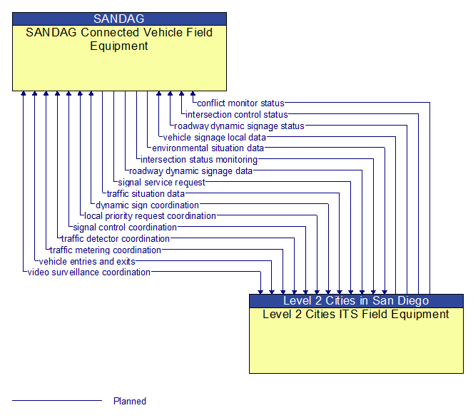
Interface: SANDAG Connected Vehicle Field Equipment - Level 2 Cities ITS Field Equipment
Information Flow Definitions
conflict monitor status (Planned)
A control flow that supports failsafe operation in the event that a conflict is detected that requires the RSE to enter a failsafe operating mode for intersection management. Analogous to a traffic signal conflict monitor, this flow is issued when differences are detected between information provided to the vehicle for in–vehicle display and information displayed by field devices. It contains the details of differences that were found.
dynamic sign coordination (Planned)
The direct flow of information between field equipment. This includes information used to initialize, configure, and control dynamic message signs. This flow can provide message content and delivery attributes, local message store maintenance requests, control mode commands, status queries, and all other commands and associated parameters that support local management of these devices. Current operating status of dynamic message signs is returned.
environmental situation data (Planned)
Aggregated and filtered vehicle environmental data collected from vehicle safety and convenience systems including measured air temperature, exterior light status, wiper status, sun sensor status, rain sensor status, traction control status, anti–lock brake status, and other collected vehicle system status and sensor information. This information flow represents the aggregated and filtered environmental data sets that are provided by the RSE to the back office center. Depending on the RSE configuration and implementation, the data set may also include environmental sensor station data collected by the RSE.
intersection control status (Planned)
Status data provided by the traffic signal controller including phase information, alarm status, and priority/preempt status.
intersection status monitoring (Planned)
Current signal phase and timing information for all lanes at a signalized intersection. This flow represents monitoring of communications by a receiver at the intersection to support monitoring for conflicts between actual signal states and RSE communications about those states.
local priority request coordination (Planned)
The direct flow of information between field equipment. This includes notification of crossing calls from pedestrians and other vulnerable road users and requests for signal prioritization or preemption, and any other request for right–of–way at an intersection. The status of the priority request is also shared. For vulnerable road users, this includes information provided to guide and warn vulnerable road users at crossings including crossing permission status and crossing time remaining.
roadway dynamic signage data (Planned)
Information used to initialize, configure, and control dynamic message signs. This flow can provide message content and delivery attributes, local message store maintenance requests, control mode commands, status queries, and all other commands and associated parameters that support remote management of these devices.
roadway dynamic signage status (Planned)
Current operating status of dynamic message signs.
signal control coordination (Planned)
The direct flow of information between field equipment. This includes configuration and control of traffic signal controllers or field masters. Configuration data and operational status of traffic signal control equipment including operating condition and current indications are returned.
signal service request (Planned)
A call for service or extension for a signal control phase that is issued by the RSE for connected vehicles approaching an intersection and/or pedestrians at a crosswalk. This flow identifies the desired phase and service time.
traffic detector coordination (Planned)
The direct flow of information between field equipment. This includes information used to configure and control traffic detector systems such as inductive loop detectors and machine vision sensors Raw and/or processed traffic detector data is returned that allows derivation of traffic flow variables (e.g., speed, volume, and density measures) and associated information (e.g., congestion, potential incidents). This flow includes the traffic data and the operational status of the traffic detectors
traffic metering coordination (Planned)
The direct flow of information between field equipment. This includes control commands and operating parameters for ramp meters, interchange meters, mainline meters, and other systems equipment associated with roadway metering operations. Current operational status of the traffic metering status is also provided.
traffic situation data (Planned)
Current, aggregate traffic data collected from connected vehicles that can be used to supplement or replace information collected by roadside traffic detectors. It includes raw and/or processed reported vehicle speeds, counts, and other derived measures. Raw and/or filtered vehicle control events may also be included to support incident detection.
vehicle entries and exits (Planned)
Information exchanged between an RSE and ITS Roadway Equipment that supports detection of non–equipped vehicles in an automated lane, low emissions zone, or other facility where V2I communications is used to monitor vehicles at entry or exit points. This exchange also supports identification of non–equipped vehicles where an RSE is used for payment collection. This generic exchange can be implemented by any approach that compares vehicle detections with V2I communications by the RSE to identify vehicles that are not equipped or are otherwise unable to communicate with the RSE.
vehicle signage local data (Planned)
Information provided by adjacent field equipment to support in–vehicle signing of dynamic information that is currently being displayed to passing drivers. This includes the dynamic information (e.g., local traffic and road conditions, work zone information, lane restrictions, detours, closures, advisories, parking availability, etc.) and control parameters that identify the desired timing, duration, and priority of the signage data.
video surveillance coordination (Planned)
The direct flow of information between field equipment. This includes information used to configure and control video surveillance systems and the high fidelity, real–time traffic images and associated meta data that are returned.