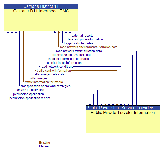
Interface: Caltrans D11 Intermodal TMC - Public Private Traveler Information
Information Flow Definitions
automated lane control data (Planned)
Control commands and operating parameters for automated vehicle operations, including tightly coupled platooned groups of vehicles operating in dedicated or mixed–mode lanes. This flow includes platoon parameters including maximum platoon size, target speeds and gaps, and vehicle restrictions.
device identification (Planned)
An identifier and device type designation that is used to uniquely identify a device in the Connected Vehicle Environment.
external reports (Planned)
Traffic and incident information that is collected by the media through a variety of mechanisms (e.g., radio station call–in programs, air surveillance).
fare and price information (Planned)
Current transit, parking, and toll fee schedule information.
incident information for public (Planned)
Report of current desensitized incident information prepared for public dissemination.
logged vehicle routes (Planned)
Anticipated route information for guided vehicles, special vehicles (e.g., oversize vehicles) or groups of vehicles (e.g., governor's motorcade) that may require changes in traffic control strategy.
permission application (Planned)
A request for permission to access a Connected Vehicle service by an end–user that requires enrollment. This may include services granted to drivers of low emissions vehicles or pedestrians with special needs that require extended crossing times for example.
permission application receipt (Planned)
An acknowledgment that an end–user application for a Connected Vehicle service was received and processed.
restricted lanes information (Planned)
This flow defines the location, duration, and operating parameters for lanes that are reserved for the exclusive use of certain types of vehicles (e.g., transit vehicles) or vehicles that meet other qualifications (e.g., number of occupants, low emissions criteria). It identifies the lane(s), the start and stop locations, start and end times, vehicle restrictions, speed limits and platooning parameters.
road network conditions (Planned)
Current and forecasted traffic information, road and weather conditions, and other road network status. Either raw data, processed data, or some combination of both may be provided by this flow. Information on diversions and alternate routes, closures, and special traffic restrictions (lane/shoulder use, weight restrictions, width restrictions, HOV requirements) in effect is included.
road network environmental situation data (Existing)
Aggregated environmental situation data collected from vehicles and other sources for the road network. Aggregated information would include measured air temperature, exterior light status, wiper status, sun sensor status, rain sensor status, traction control status, ALB status, and other collected vehicle system status and sensor information for the region.
road network traffic situation data (Planned)
Aggregated route usage, travel times, and other aggregated data collected from probe vehicles that can be used to estimate current traffic conditions.
traffic control information (Existing)
Represents the flow of traffic control and status information between centers. This is reporting only, not actual control. This specifically includes the current state of any demand management strategies that have been implemented.
traffic image meta data (Planned)
Meta data that describes traffic images. Traffic images (video) are in another flow.
traffic images (Planned)
High fidelity, real–time traffic images suitable for surveillance monitoring by the operator or for use in machine vision applications. This flow includes the images. Meta data that describes the images is contained in another flow.
traffic information for media (Existing)
Report of traffic conditions including traffic incident reports for public dissemination through the media. The reports may also include information on diversions and alternate routes, closures, and special traffic restrictions in effect.
transportation operational strategies (Planned)
Operational strategies for each operating agency in a transportation corridor, downtown area, or other travel–impacted area, providing an integrated operations strategy for the freeways, tollways, arterials, transit services, parking facilities, and other transportation–related facilities in the area. These strategies can include dynamic adjustments to transit fares and tolls, parking fees and restrictions, dynamic lane restriction changes, and other active demand management strategies.